
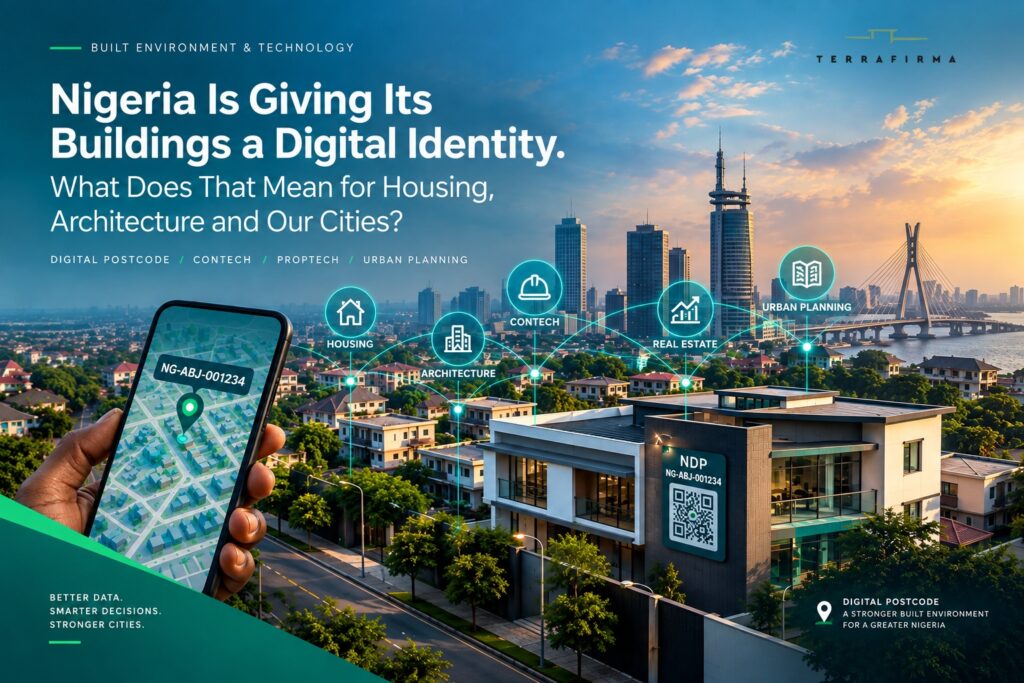
By Arcladytect for TerraFirma Designs Limited
There are few things more Nigerian than giving directions to a building.
“Come through this road.”
“After the filling station, take the second turning.”
“You will see a big house with a black gate.”
“Call me when you get there. I’ll direct you from there.”
We have become remarkably good at navigating a country where an address can sometimes be more of a conversation than a location.
For decades, this has been more than a Nigerian peculiarity. It has been a symptom of a deeper problem: we have built millions of places that are difficult for our systems to reliably identify.
That may be about to change.
The Federal Government of Nigeria is rolling out a National Digital Alphanumeric Postcode System intended to give addressable buildings across Nigeria a unique, geographically anchored digital identifier.
The Federal Executive Council approved the implementation of a GIS-enabled Alphanumeric Digital Postcode System in March 2026. The Federal Ministry of Communications, Innovation & Digital Economy subsequently described the initiative as a component of Nigeria’s Digital Public Infrastructure, with applications extending beyond postal services to national planning, emergency response, security, logistics, e-commerce and public-service delivery.
NIPOST has been even more specific about the built environment.
At the June 2026 Postcode Delineation Model Validation exercise, Postmaster-General and CEO Tola Odeyemi described the postcode as:
“a machine-readable standard location address for every addressable building in Nigeria.”
The national rollout is scheduled for 1 October 2026, according to the official NIPOST digital postcode platform, while nationwide field validation has already been underway.
At first glance, this sounds like a postal matter.
For anyone who works with land, buildings, cities and infrastructure, it deserves considerably more attention.
Because once a building has a reliable digital identity, a new question becomes possible:
What else can we attach to it?
We have always had buildings. We have not always had reliable information about them.
Walk through almost any Nigerian city and you will see layers of development sitting on top of one another.
A family house becomes a short-let.
A residential building becomes an office.
A bungalow becomes a three-storey building after several additions.
A former industrial site becomes a commercial centre.
New estates appear where farmland existed a few years earlier.
The physical environment is constantly changing.
Our information about it often struggles to keep pace.
A single property may have a survey plan, a planning approval, a valuation report, utility records, tax information, photographs, architectural drawings, construction records and a listing on a property platform. Each record may describe the same place differently.
Sometimes the only thing holding the information together is the person who knows the property.
That is a weak system for a country whose cities are growing as quickly as ours.
A standardized digital location identifier gives us an opportunity to start building something better.
The postcode itself will not contain the entire history of a building. Its immediate job is more straightforward: provide a consistent, machine-readable spatial reference for an addressable location.
The Federal Ministry has described the system as assigning locations a “unique, machine-readable and geographically anchored identity.”
That reference can become the point at which other information meets.
And that is where things get interesting.
The building is becoming a data point
This is where the conversation gets interesting for the built environment.
Architects are accustomed to thinking about buildings through drawings and specifications. Developers look at land, markets, cost and returns. Planners look at land use and urban growth. Surveyors deal with boundaries and spatial information. Valuers assess assets. Facility managers keep buildings functioning long after the design team has left.
Construction professionals work with another enormous layer of information: quantities, materials, programmes, contractors, equipment, site records, inspections, variations, costs and as-built information.
These are increasingly becoming the territory of ConTech — construction technology designed to make the planning, delivery, monitoring and management of construction more intelligent and connected.
All of these professionals are dealing with different pieces of the same physical reality.
Increasingly, that reality is also digital.
A building has a location.
It has a use.
It has a size.
It has a construction history.
It consumes resources.
It depends on infrastructure.
It has an economic value.
It may have planning approvals, alterations, maintenance records and environmental risks associated with it.
The more reliably we can identify the physical asset, the easier it becomes to organize information around it.
This is why the national postcode initiative deserves to be viewed through a wider lens.
It is laying down part of the infrastructure required for a more data-driven built environment.
If housing is a human right, we need to know where the housing is
The timing of Nigeria’s digital postcode rollout is particularly interesting because October also brings two of the built environment’s most important global observances together.
On 5 October 2026, the International Union of Architects will mark World Architecture Day under the theme:
“Housing is a Human Right. Build It.”
On the same day, the United Nations will mark World Habitat Day around the theme:
“Adequate Housing for All.”
The themes point to something that architects and built-environment professionals sometimes separate too easily.
Housing is not simply about producing buildings.
It is about whether people can access adequate homes, whether those homes are connected to infrastructure and services, whether communities are properly planned, and whether the places people inhabit are visible within the systems that govern our cities.
You cannot adequately plan what you cannot reliably locate.
Housing policy is often discussed in terms of numbers: how many units Nigeria needs, how much housing costs, how many people live in informal settlements, how much land is available for development.
But housing is also spatial.
Where are the homes?
Who lives there?
What infrastructure serves them?
Which communities are growing?
Which neighbourhoods are underserved?
Where are schools, clinics, roads, drainage systems and transport connections failing to keep pace with development?
A building-level digital addressing system does not answer all of these questions by itself.
It does, however, create something fundamental: a reliable spatial reference against which other information can potentially be organised.
And that matters if we are serious about adequate housing for all.
What could this mean for Nigerian cities?
Consider Lagos.
Development along a corridor can change dramatically within a few years. A residential street can become a commercial strip. Traffic patterns change. Buildings are redeveloped. Population increases. Infrastructure comes under pressure.
Now imagine being able to analyse that change at building level.
How many buildings are in a particular area?
What are they being used for?
How quickly is development occurring?
Where is commercial activity expanding?
Where are buildings concentrated around existing infrastructure?
Which areas are increasingly exposed to flooding or other environmental risks?
How is the physical form of a neighbourhood changing?
Those are planning questions.
They are also data questions.
A national building-level addressing framework could become one of the datasets that help planners answer them with greater precision.
The implications extend beyond Lagos. Abuja, Port Harcourt, Ibadan, Kano, Benin City, Enugu and other rapidly growing urban centres face their own versions of the same challenge.
Nigeria is urbanising at a scale that demands better information about the places we are building.
The Federal Government itself has identified better national planning among the expected uses of the new digital postcode infrastructure.
The opportunity for the planning profession is to think about what that statement should mean in practice.
For developers, location could become much more intelligent
Property development decisions are already information-heavy.
Before committing substantial capital to a site, a developer needs to understand its planning context, surrounding development, infrastructure, access, market, environmental conditions and development potential.
A digital location identifier could eventually become one of the building blocks for bringing those datasets together.
Think about a development site.
Its digital identity could provide the starting point for connecting authorized information about:
- planning and zoning;
- surrounding development;
- infrastructure;
- environmental conditions;
- market activity;
- property values;
- demographic patterns;
- transport access.
The result could be a much richer form of feasibility analysis.
A developer could move from asking, “What is around this site?” to asking much more precise questions about what is happening within a defined spatial environment.
That is where location intelligence becomes valuable.
It also creates opportunities for ConTech and PropTech to overlap.
A developer could use spatial intelligence during acquisition and feasibility, move into digital project planning and cost management during delivery, and then carry relevant asset information into property and facilities management after completion.
The technology stack would no longer end at construction.
It would follow the asset.
For the Nigerian real estate market, this could be a significant evolution.
The Technological Innovation opportunity underneath
Much of PropTech in Nigeria has focused on making property transactions easier.
Listings.
Payments.
Property management.
Tenant services.
Digital documentation.
Those are important.
There is another opportunity emerging underneath all of them: the digital representation of the physical asset itself.
Imagine a property platform where a building can be consistently identified across different services.
Imagine a property manager using the same identifier throughout an asset’s operational life.
Imagine a valuation system that can associate comparable properties with verified locations.
Imagine an insurance platform that can assess location-specific risks.
Imagine a developer using spatial data to understand an emerging market before acquiring land.
The technology becomes more useful when everyone is talking about the same physical place.
That is the promise of a standardized location layer.
But PropTech is only one side of the opportunity.
The other side is ConTech.
Before a building becomes an asset on a property platform, someone has to design it, cost it, procure it, construct it, inspect it and hand it over.
That process generates enormous amounts of information.
If the building has a persistent digital identity from the beginning, there is an opportunity for the information generated during design and construction to remain connected to the asset after completion.
The postcode could therefore become one of the bridges between the construction technology ecosystem and the property technology ecosystem.
And government appears to understand the broader economic potential. In announcing the FEC approval, the Minister of Communications, Innovation & Digital Economy, Dr. Bosun Tijani, said the system would support “better national planning, improved emergency response, more efficient logistics and e-commerce, and the delivery of government services.”
Those are not small applications.
They point towards location becoming part of Nigeria’s wider digital infrastructure.
Architects should be interested too
There is a tendency to think of digital transformation in architecture as a conversation about software.
CAD.
BIM.
Parametric design.
Rendering.
Artificial intelligence.
Those tools matter.
The bigger change may be happening around the building itself.
What happens to the information about a building after construction?
Who has it?
Where is it stored?
Can another professional access it ten years later?
What happens when the building changes ownership?
What happens when the building is renovated?
What happens when its use changes?
What happens when the original architect is no longer involved?
A persistent digital identity could help us begin to think about the building as a lifecycle asset.
This is where architecture, ConTech and asset management begin to intersect.
A BIM model, for example, can contain detailed information about a building. Construction platforms can contain procurement and project data. Digital twins can potentially represent operational conditions. Facility-management systems can track equipment and maintenance.
But these systems still need a reliable connection to the physical asset they represent.
Where is the building?
A national location identifier could provide one important answer.
The national postcode system would not create a BIM model, digital twin or building passport on its own.
It could, however, provide an important location anchor for those systems.
That distinction is worth making now, before expectations become confused.
ConTech could change what happens between the drawing and the building
There is another reason construction technology deserves a seat in this conversation.
The most important information about a building is often generated before anyone occupies it.
Design decisions affect cost.
Site conditions affect programme.
Material choices affect procurement.
Procurement affects construction.
Construction affects quality.
Variations affect cost and time.
Inspections affect compliance.
As-built conditions affect future maintenance.
Yet these information streams are often fragmented across consultants, contractors, suppliers and clients.
This is precisely the kind of problem ConTech is trying to address.
Digital estimating.
Construction management platforms.
BIM.
Site monitoring.
Digital procurement.
Geospatial construction data.
Drone and reality capture.
AI-assisted project controls.
Digital quality assurance.
These technologies can make the construction process more connected.
A reliable building identifier could give that information a persistent spatial reference.
Instead of treating the building as the endpoint of a construction project, we can begin treating it as the long-term asset around which project information accumulates.
That is a subtle change in thinking.
It could have major consequences.
Facilities management could benefit enormously
Nigeria spends considerable resources constructing buildings.
We are less consistent about preserving the information needed to operate them well.
Architectural drawings get misplaced.
Equipment schedules disappear.
Maintenance histories live in spreadsheets, notebooks or WhatsApp conversations.
A new facility manager arrives and has to reconstruct the building’s history.
For a single house, this may be inconvenient.
For a hospital, university, hotel, industrial facility or large residential estate, it becomes a serious operational issue.
A persistent building identifier could help connect an asset to its records throughout its life.
The long-term vision could look something like:
Building identity → design information → construction records → approvals → equipment → maintenance → alterations → performance
This is where ConTech, PropTech and facilities technology begin to converge.
The technology used to design and construct a building should not necessarily become irrelevant once the building is handed over.
The asset can carry its information forward.
The building continues to have a life after the professional fee has been earned and the keys have been handed over.
Its information should have a life too.
There is an infrastructure story here too
Buildings do not exist in isolation.
Every building interacts with a larger system.
Roads.
Drainage.
Electricity.
Water.
Telecommunications.
Waste management.
Public transport.
Emergency services.
When government and infrastructure providers have better information about where buildings are and how they are distributed, they can potentially make better decisions about where infrastructure is needed and how demand is changing.
This is particularly relevant to rapidly expanding urban areas.
We often build first and struggle with infrastructure afterwards.
Better spatial information could help us anticipate some of that pressure.
It will not solve infrastructure deficits by itself.
It can, however, improve the quality of the information on which infrastructure decisions are based.
That is why the Federal Ministry has framed the postcode as a foundational digital infrastructure rather than simply a postal-service upgrade.
For the built environment, this is significant.
The digital infrastructure beneath the city may increasingly influence how the physical infrastructure above it is planned.
And then there is emergency response
This may be one of the easiest benefits for the public to understand.
When a building is on fire, or collapses, someone is trapped, a flood has isolated a neighbourhood or an emergency team needs to reach an unfamiliar location, precision matters.
A digital location identifier could make it easier for response systems to identify and communicate a building’s location.
The June national workshop was held under the theme:
“Operationalising the Nigerian Digital Postcode for National Security and Public Safety.”
The Federal Ministry says the system is expected to strengthen emergency response, national security and public-service delivery.
The important word here is could.
For that promise to become reality, emergency agencies and other relevant systems have to adopt the addressing infrastructure and build it into their operations.
A database sitting in isolation will not save anyone.
Interoperability will determine how useful this becomes.
But digitising the built environment comes with serious questions
There is a temptation whenever new technology arrives to focus on what it can do.
We should also ask what could go wrong.
Who maintains the database?
How are new buildings added?
What happens when a building is demolished?
How are extensions and major alterations treated?
How are apartment blocks and multi-unit developments represented?
How are informal settlements handled?
How is accuracy verified?
What happens when the physical city changes faster than the database?
And perhaps the most important question:
Who gets to see the information?
A location identifier on its own is relatively straightforward.
The situation changes when location is connected to information about individuals, ownership, finances, property value or other sensitive records.
The government’s decision to position the postcode within the wider digital public infrastructure ecosystem makes this particularly important.
Digital infrastructure is still infrastructure.
It needs standards, maintenance, accountability and security.
And as ConTech, PropTech and other built-environment technologies begin consuming national location data, interoperability and data governance become industry issues, not merely government IT issues.
The built environment needs to get into the conversation
There is an opportunity here for our professional institutions and practitioners.
Architects should be asking what information ought to accompany a building throughout its lifecycle.
Planners should be considering how building-level data can improve urban management.
Surveyors should be thinking about how digital addressing interacts with cadastral information.
Valuers should be exploring what better location intelligence means for property markets.
Developers should be thinking about how data can improve site selection and feasibility.
Construction professionals should be asking how ConTech platforms can connect project information to the physical assets they create.
Facility managers should be preparing for more connected asset information.
And PropTech founders should be looking beyond the transaction to the physical asset underneath it.
There is a risk that the built environment will simply receive whatever digital system is handed to it.
We can do better.
The people who design, regulate, finance, estimate, procure, build, value, market and manage Nigeria’s physical environment should have a voice in deciding how its digital counterpart develops.
And they should be prepared to actively build it.
The bigger question is what comes after the postcode
Giving buildings unique digital identifiers is useful.
What we build around those identifiers will determine whether the initiative becomes transformative.
A postcode can help a delivery rider find a building.
A well-designed digital infrastructure can help a city understand its buildings.
That is a much bigger ambition.
Imagine being able to move through a building’s lifecycle with reliable information:
Site → Design → Estimate → Approval → Procurement → Construction → Handover → Occupancy → Operation → Renovation → Redevelopment
Imagine that information remaining associated with the physical asset even when ownership, consultants, contractors, tenants and facility managers change.
Imagine a developer using location intelligence before acquiring land.
A design team using verified site and context information.
A contractor connecting project records to the asset being constructed.
A ConTech platform carrying project information into handover.
A facility manager inheriting a usable digital record rather than reconstructing the building’s history.
A PropTech platform using the same underlying location identity for property management and transactions.
A planner seeing urban growth through building data.
A valuer working with better location information.
An emergency service having more reliable building-level information.
Imagine all of these systems being able to refer to the same physical place.
That begins to look like a digital representation of the built environment itself.
And perhaps that is where the connection with this year’s World Architecture Day and World Habitat Day becomes most important.
“Housing is a Human Right. Build It.”
“Adequate Housing for All.”
Both themes ultimately ask us to look beyond the individual building.
Housing is connected to land.
Land is connected to infrastructure.
Infrastructure is connected to communities.
Communities are connected to cities.
Cities are increasingly connected to data.
And the technologies we use to design, construct, operate, finance and manage those places are becoming increasingly connected too.
Nigeria may therefore be solving a very old problem — the difficulty of finding a building — with a very modern piece of infrastructure.
But the real opportunity is much larger.
If every addressable building can have a reliable digital identity, we can begin asking better questions about the places where Nigerians live.
Where is the housing?
What condition is it in?
Who and what does it serve?
What surrounds it?
What infrastructure reaches it?
How was it designed and built?
How is it performing?
How is it changing?
What risks does it face?
How should the neighbourhood around it evolve?
The postcode will not answer those questions.
It may, however, give us a better place to start asking them.
And that is why architects, planners, developers, surveyors, engineers, contractors, estimators, valuers, facility managers, PropTech and ConTech founders should be watching what happens next.
Because if housing is a human right, then adequate housing cannot be an invisible line item in a national spreadsheet.
It has a location.
It has a physical reality.
It has a community around it.
It has a lifecycle.
And increasingly, it may have a digital identity too.
The code is coming.
What we build around it is up to us.
Sources & further reading
Federal Ministry of Communications, Innovation & Digital Economy — The Ministry’s June 2026 briefing on the National Digital Alphanumeric Postcode System, including its positioning as Digital Public Infrastructure and its proposed applications in national planning, emergency response, security, logistics and public services. Read the Federal Ministry briefing
Federal Ministry of Communications, Innovation & Digital Economy — March 2026 announcement confirming Federal Executive Council approval of the GIS-enabled Alphanumeric Digital Postcode System. Read the March 2026 announcement
Nigerian Postal Service / reporting on NIPOST’s validation exercise — Details on the building-level, machine-readable addressing framework and NIPOST’s explanation of the system. Read the NIPOST report
The Guardian Nigeria — Reporting on the planned October 2026 launch and the intention to assign unique digital postcodes to buildings across Nigeria. Read The Guardian’s report
The Punch — Reporting on NIPOST’s plan to assign unique digital addresses to addressable buildings nationwide. Read The Punch’s report
NIPOST nationwide field validation — Reporting on the commencement of the Postcode Model Field Validation Exercise. Read the validation report
Federal Ministry / national security workshop — The government’s stated focus on operationalising the digital postcode for national security and public safety. Read the workshop briefing
Ministerial announcement and implementation update — Dr. Bosun Tijani’s public update on postcode delineation model validation and the October rollout. Read the implementation update
The digital transformation of the built environment is already underway.
At TerraFirma, we explore how technology, business and design can work together to create a more connected built environment in Africa.
TerraFirma Designs Limited
Empowering Professionals, Revolutionizing Businesses™

A very thoughtful and insightful analysis.
Well done!!!Thank you for such a thoughtful contribution. I agree with your point about the continuity of information. Technology becomes truly valuable when knowledge can outlive the individual who holds it.
And I think you’ve touched on one of the most important questions beyond the technology itself: trust. A digital system that captures increasingly valuable information about our buildings and people must have equally strong frameworks for privacy, access, security, accountability, maintenance and transparency.
The technology may create the infrastructure, but trust will determine how widely and meaningfully it is adopted.Who will take on this task and remain accountable?
Interesting read, very insightful the alphanumeric postcode is a genius innovation, it’s serves as a nucleus where contech, proptech and other building technology can be attached and grow from. What caught my eye is the transferring of a building history, usage, ownership information from one informed mind to another and not having to break every down and rebuild again is the core beauty of technology. The crux of the information remains, unfortunately Nigerians don’t trust their government, when the database is running, who maintains the privacy of information of the citizens? Will the information be uploaded to a cloud storage for posterity sake? how is it being handled, who is accountable to who? Transparency and trust needs to be seen to enable people adapt to the emerging rise of this technology.
Thank you so much! 👏🏾 Sometimes, the simplest interventions can have far-reaching implications when we look at the bigger picture. Thank you for reading and engaging!
This is a really interesting read. I like how you connected something as simple as a postcode to the bigger picture of how we plan, build and manage our cities. Well done 👏🏾.
Thank you very much Prof. I truly appreciate it.
I’m increasingly convinced that the quality of the answers and outcomes we get is often determined by the quality of the questions we are willing to ask. Sometimes, a new policy becomes even more valuable when we pause to ask what else it could mean, who else it affects, and what opportunities or challenges may sit beneath the obvious.
Thank you for reading and for engaging with it.
Great elucidation on the new policy with analysis on related fields including architecture! Well done, lady architect!
Hi AUGEO, very important question.
From what has been published so far, the system is GIS-enabled and building-level, involving geospatial mapping, field verification, digital location data and database infrastructure.
There could be significant opportunities for surveyors, architects, engineers, geospatial professionals, mapping firms and technology providers in areas such as field verification, data collection, mapping, QA and local implementation.
I haven’t seen a public framework yet outlining specific subcontractor categories, but NIPOST is already inviting startups, enterprises and government bodies interested in integrating with the system to register their interest ahead of the developer portal.
NIPOST is gathering information on how startups, enterprises and government intend to integrate the postcode system and invites them to register their interest.
You can register through the official platform here: NIPOST Digital Postcode
On the page, look for Building something with addresses? and select Register integration interest. The site also lists g2g@postcode.gov.ng and postcode@nipost.gov.ng for contact.I think the bigger question for our industry is: how do we position Nigeria’s existing built-environment and technology ecosystem to participate in implementing this infrastructure, rather than simply using it once it is built?
Hi, AUGEO here!
What’s the technology to be used to carry out this digitisation and how can relative stakeholders in the construction sector key in to come in as ad-hoc subcontractors to carryout the fulfilment of this scheme contractually?


Thank you very much!